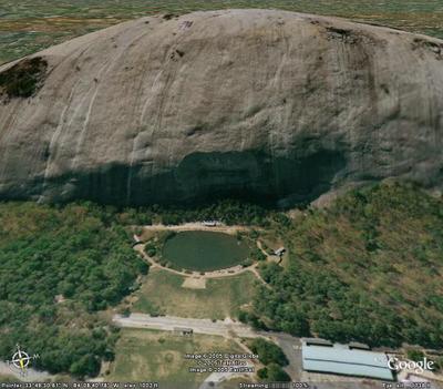
Holy Crap.
The Web-based Google Maps site, with the ability to jump back and forth between a map and a satellite image, was impressive enough. They’ve also added a Hybrid view, which combines elements of the maps with satellite imagery. But Google Earth, which uses a program that resides on your computer, is ridiculous.
You start with a 3D image of the Earth floating in space, as seen from a distance of about 4,000 miles. Type in a location - a postal code, a city name, a street address, a three-letter airport code, a geographical feature - and instantly, you zoom right to it. The images are downloaded as you scan, zoom, or tilt the landscape.

Depending on what part of the planet’s surface you are looking at, the level of detail ranges from 15-meter resolution all the way down to 1-foot (!) Many of the images date from two or three years ago, but the mapping is constantly being upgraded.
I can look at my house and see whether there was a car in the driveway when the photograph was taken. I can look at the crater of Mount St. Helens in three dimensions, or spin my way around Stone Mountain. I can bring my point of view to 50 feet above Runway 9R at Atlanta’s Hartsfield-Jackson International Airport.

Aside from the sheer Google-eyed wonder of it, there’s the beauty of our little planet to consider, too. Here is a random view of the Alaskan wilderness:

The only real issue I have with Google Earth is that it can become a huge time sink. It’s all too easy to get lost for hours, looking at the Big Blue Marble that is our planetary home.


No comments:
Post a Comment